
Audio By Carbonatix
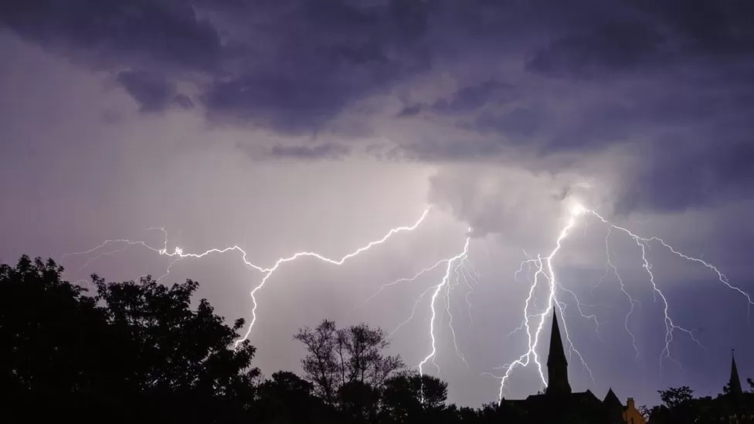
Thunderstorms, winds and hail are forecast to sweep across the UK this weekend and could cause flash flooding, the Met Office has warned.
It said warm, humid air this week has caused the storms to develop.
A yellow weather warning for England and Wales is in place for Sunday, with an unsettled weekend of weather on the way for some.
But the hot weather will continue, with temperatures reaching highs of 29C (84F) in some areas.
The storms could also lead to power cuts.
There is a chance homes could be flooded quickly as some areas see up to 30mm of rainfall in an hour, the Met Office said.
BBC Weather meteorologist Matt Taylor said on Saturday it was the western half of Northern Ireland that was most likely to experience thunderstorms, with a yellow warning issued for the area between 14:00 and 21:00 BST.
A yellow warning is the lowest of three warnings the Met Office can issue and means there could be some disruption to travel in a few places.
Mr Taylor said: "There's an increasing chance of thunderstorms developing across the UK and Ireland through the weekend, as humidity levels continue to rise.
"On Sunday, more of us could see the chance of some severe storms developing, with the Met Office having issued a yellow warning widely across Wales and most of England for the entire day.
"Storms are most likely to develop from late morning onwards, with the risk of frequent lightning, hail, strong winds and some flooding leading to disruption.
Mr Taylor added that some of the worst storms could result in more than a month's worth of rain in just a few hours, leading to flash flooding.
However, he said that not everyone will see the storms, with conditions "highly variable over just short distances, and many areas remaining dry".
Late on Sunday, and into the night, the thundery rain could affect more of northern and eastern England, as well as eastern Scotland, he added.

The stormy forecast follows a week of high temperatures, where many parts of the UK officially experienced a heatwave.
Heatwaves are becoming more likely and more extreme because of human-induced climate change.
The world has already warmed by about 1.2C since the industrial era began, and temperatures are expected to keep rising.
Despite the storms, the heat is set to continue. The highest temperature of the year so far was at Chertsey Water Works in Surrey on Saturday where highs of 32.2C were recorded.
A hosepipe ban was issued in Kent and Sussex on Friday after South East Water said it had no choice after demand for drinking water reached "record levels" in June.
Up to 4,000 customers are without water or have been experiencing low pressure since Monday due to supply issues.
Latest Stories
-
Berekum Chelsea edge Aduana FC in Bono derby to boost survival hopes
1 hour -
‘They can’t control the team’ – Ernest Thompson doubts local coaches for Black Stars role
2 hours -
Ghana-born midfielder Seidu realises ‘dream’ with Atlético Madrid debut
2 hours -
GPL 2025/26: Bubakari strikes late to hand All Blacks vital win over Dreams FC
2 hours -
Fatal crash on Kintampo–Tamale highway claims four lives
2 hours -
2025–26 FA Cup Semifinal Draw: Chelsea, Man City Learn Wembley Opponents
3 hours -
GPL 25/26: Gold Stars back on top after beating Nations FC
3 hours -
GPL 2025/26: Heart of Lions roar back with victory over Vision FC in Kpando
4 hours -
Solomon Agbasi: Hearts keeper in stable condition after concussion
4 hours -
GPL 2025/26: Late Salim Adams penalty earns Medeama draw at Bechem
4 hours -
Hearts pip Young Apostles 1-0 to end 5-game winless run
5 hours -
Boakye Agyarko marks Easter Sunday with a call for Godly leadership ahead of nationwide campaign tour
6 hours -
Pepsi withdraws as UK festival sponsor after Kanye West backlash
6 hours -
Pope Leo calls for global leaders to choose peace in his first Easter Mass
6 hours -
Kpando MP highlights progress on road projects
6 hours