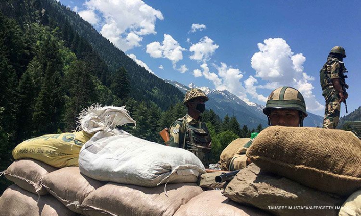
China and India on Monday agreed to stop sending more troops to their disputed border in the Himalayas, following an escalation in tensions between the two nuclear powers.
Indian and Chinese senior military commanders met on Monday to discuss stabilizing tensions along the Line of Actual Control (LAC), the loosely defined demarcation line that separates the two countries.
In a joint statement, both sides agreed to strengthen communication on the ground to avoid misunderstandings or action "that may complicate the situation."
They also agreed to not take any unilateral action that would change the situation on the ground, according to the statement. Another round of high-level military meetings will be held "as soon as possible," the statement said.
Tensions have been rising in the Himalayas since a bloody clash between Indian and Chinese troops in June and efforts to deescalate in the wake of the violence appeared to be faltering.
At least 20 Indian soldiers were killed in that incident, the deadliest border conflict with China in over 40 years. China has never acknowledged any casualties from that clash.
Meetings were immediately set up between top Chinese and Indian military officials, and both sides called for calm, but in early September both New Delhi and Beijing accused each other of illegally crossing into their territories, leading to a renewed bout of saber-rattling on both sides.
A week later, China and India accused each other's troops of firing warning shots across the Sino-Indian border, reportedly the first such case in more than four decades. Both sides blamed the other for violating bilateral agreements and taking "provocative" actions.
India and China share a 2,100 mile-long (3,379-kilometer) border in the Himalayas, but both sides claim territory either side of it.
The most recent dispute was around Pangong Tso, a strategically located lake some 14,000 feet (4,200 meters) above sea level that spans an area stretching from the Indian territory of Ladakh to Chinese-controlled Tibet, in the greater Kashmir region, where India, China and Pakistan all claim territory.
The Line of Actual Control, which marks the de facto border and passes through the lake, was established in the wake of the 1962 Sino-Indian war.
Though it shows up on maps, India and China do not agree on its precise location and both regularly accuse the other of overstepping it, or seeking to expand their territory.
In 1996, the two countries signed an agreement which states that neither side shall open fire within 2 kilometers (1.24 miles) from the LAC to "prevent dangerous military activities."
Latest Stories
-
OSP declares former Finance Ministry Advisor wanted over SML corruption probe
8 minutes -
From a metal container to global platforms: The inspiring story of Eleanor Ayaovi
15 minutes -
Eric Opoku to contest NDC flagbearership
16 minutes -
JOSCO Principal urges graduating teachers to embrace AI and technology in modern-day education
22 minutes -
Court jails man for 14 years over iPhone 16 Pro Max robbery at Millennium City
34 minutes -
‘She could have died’: Doctor’s gut feeling saves young girl after bias nearly cost her life
36 minutes -
Robbers break into church at Achinakrom, bolt with musical instruments
39 minutes -
10-man Black Satellites edge Benin 1-0 in WAFU-B Boys Cup
40 minutes -
E&P vs Azumah Resources: Black Volta dispute shakes Ghana’s mining oversight – Minority asserts
43 minutes -
Ghana Athletics announce 10 athlete contingent for African U18/U20 championships in Nigeria
45 minutes -
Pathways to the financial regulation of virtual assets (crypto-assets) eco-systems in Ghana: ‘A case for hybrid financial regulatory approach’
46 minutes -
Mahama and Vice President haven’t called me since the assault – Hawa Koomson
46 minutes -
E&P and Azumah Resources dispute poses economic, legal and political risks – Minority
53 minutes -
2 arrested for impersonating Gold Board officials, extortion
1 hour -
ECOWAS urges member states to equip border personnel with multilingual skills
1 hour